


Be prepared! Plan your next trip to the Lake Tahoe area. Download maps and guides before you venture into the Wi-Fi free wilderness.
Discover
- 20+ national forests, California and Nevada state parks
- 80+ neatly folded maps by the Bureau of Land Management, United States Forest Services, and other agencies.
- Complete USGS 7.5 minutes topo maps coverage for Lake Taho and surrounding area.
- Motor Vehicle Use Maps (MVUM), Motor Vehicle Travel Maps (MVTM) and visitor maps for national forests.
- Off-Highway Vehicle (OHV) maps.
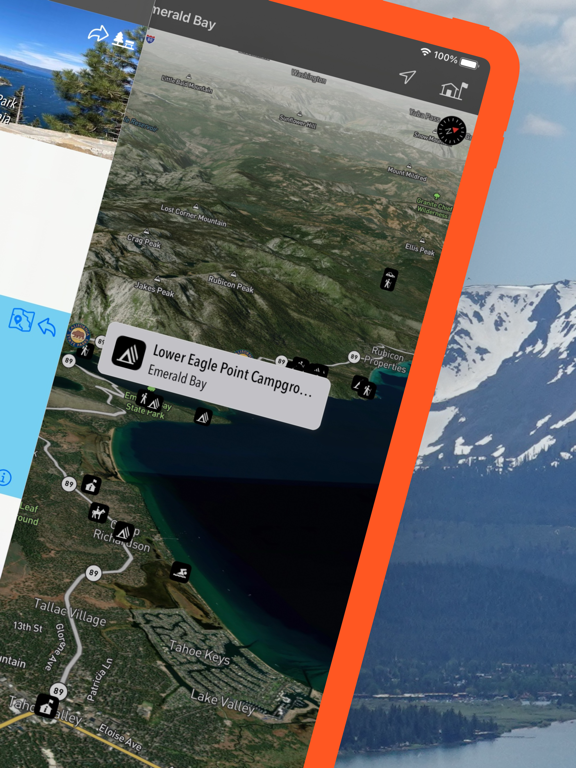
- 1,800+ campgrounds and campsites
- 1,800+ trails and trailheads
- 150,000+ points of interests
Plan
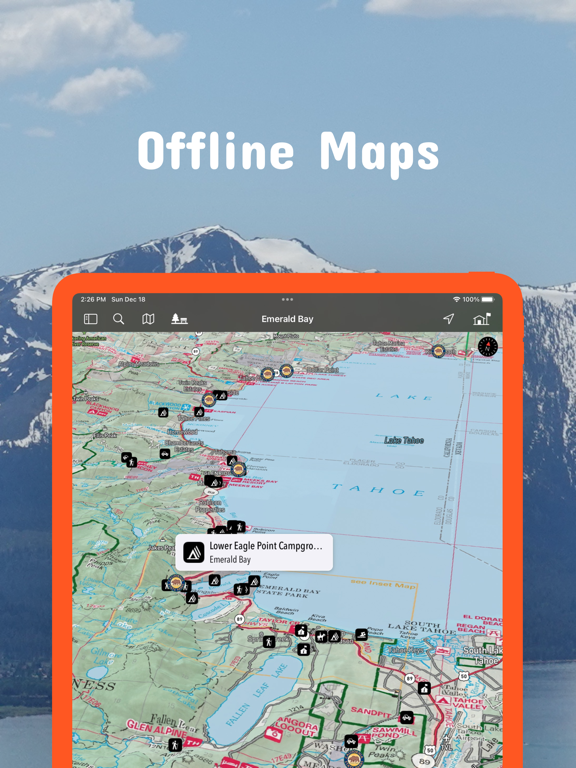
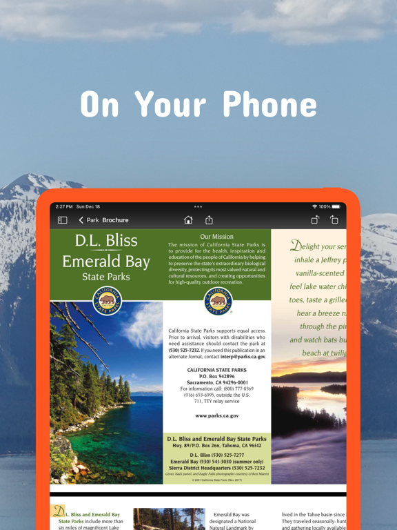
- Download maps, park brochures, and newspapers. These downloads are ready when you are offline and off the grid in the great outdoors.
- Download arbitrary map sections as offline packs.
- Photo galleries, panorama views.
- Share links to parks and maps with friends
Have fun
- GPS and GPX support: record your hikes, import GPX routes, tracks and waypoints for your hiking trails.
- Detailed national park information: alerts, news, visitor centers, campgrounds, driving directions, weather.
- Open your favorite maps app to get a route to the selected park.
- Current weather conditions, easy access to multi-day forecasts, sunrise and sunset times.
- Push notifications for park alerts, park news, weather warnings
So download maps and guides for:
National Forests
- Eldorado
- Humboldt-Toiyabe
- Tahoe
State Parks and other areas
- Burton Creek
- Cave Rock
- D. L. Bliss
- Donner Memorial
- Ed Zberg Sugar Pine Point
- Emerald Bay
- Kings Beach
- Lake Valley
- Mormon Station
- Sand Harbor
- Spooner Lake & Backcountry
- Tahoe
- Van Sickle
- Washoe Lake
- Washoe Meadows
GPS
- Continued use of GPS running in the background can dramatically decrease battery life.
LEGAL
Terms of Use: https://www.icoat.de/pocketmaps/terms
Privacy Policy: https://www.icoat.de/pocketmaps/privacy